Sometimes, weather forecasts lie to you. The day we hiked Willey and Field, and ultimately turned back from Tom because of a passing storm, we were promised clear, sunny skies. Last weekend, we learned that meteorologists really are the best liars (even if it’s unintentional). The weather forecast for the Mt. Moosilauke area threatened a 60% chance of thunderstorms the day we planned to hike it. We hauled up to New Hampshire anyway, set up our little tent at Wildwood Campground, and resigned to skipping Moosilauke if the weather was terrible in the morning.
We awoke to unexpectedly clear skies. Excited, we checked the forecast one last time to find that the storms weren’t expected to start until the early afternoon. We grabbed breakfast in North Woodstock (which is the cutest little town ever), and set out for the Moosilauke Ravine Lodge.  Much to our disappointment, the lodge was closed for a private event. On our way to the trailhead, we encountered some fun, snarky signs presumably made by the Dartmouth College students who run the lodge. Thanks for letting us know that we can’t bring our “Ford Model-T” or our llamas on the trail!
At the end of the road, we reached the starting point of our hike at 7:30 AM. The first small stretch was a gravel and dirt road, which led us to a fork in the path where we turned left. Thankfully we had our trail guide since this part wasn’t marked, but it would have been easy enough to figure out. At this point, the trail descended for a bit and took us down to Baker River, where we crossed an adorable bridge.  A group of signs indicating which directions the trails started, so we followed them right towards the Gorge Brook Trail. We turned right at the intersection with the Hurricane trail (which continued straight) and continued following the well-marked path. According to almost every hiking site we researched, Gorge Brook is one of the more popular and easier paths up to the summit. The grade ranged from easy, to moderate towards the top. We encountered the typical rocks and roots (and a thousand frogs hopping about), and the trail was wooded for a majority of the way up.
We crossed our second bridge after a short while and then were met with some trail damage. It was mainly a bunch of up-rooted trees falling over the river we were following, but it was easy enough to get around after a little thinking.  We followed the trail for 1.3 miles until we crossed a third bridge, which was noticeably wobblier than the first and second. In another 0.3 miles, we reached a plaque for the Ross McKenney Forest. What cooler way to be honored after your death than to have your own forest? After a rest and some speculation as to whether dead people haunt the memorial places dedicated to them, we pressed on to a gradually ascending, yet moderate grade. At 2.1 miles, our trail guide told us we would veer left onto an old logging road, so we did even though we had no idea what constituted a logging road. It looked like a normal trail to us. Along we way, we passed two cleared viewpoints that offered scenic views of the mountains surrounding us.
 Past the viewpoints, we began to weave in and out of the treeline on a moderately steep and rocky path. The guide we took with us described this section as the trail “flirting” with the timberline, so naturally the conversation up consisted of us personifying the trail and trees making passes at each other (we find ways to amuse ourselves).
  We broke past the timberline to a false summit with beautiful views, which we later found out were of South Peak. From there, we hiked straight 0.5 miles to the summit on a completely exposed trail that stretched across the lush, green ridge of Moosilauke. The stone tower trail markers dotted the side of the path all the way up to the summit.
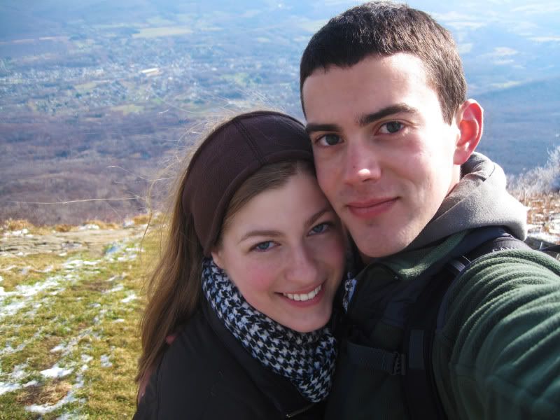
 We reached the top at 10:30 AM and were engulfed in a full, 360 degree view of our surroundings that took our breath away. Although a thin summer haze shielded some of our views from the top, we could still see miles ahead since it was a clear day. We had some fellow hikers (AT hikers! With a puppy!) take our picture by the Mt. Moosilauke elevation sign. A light breeze kept us company as we ate our sandwiches, took pictures, and scouted out the small, circular summit marker. We relaxed and soaked in the views for a good half hour, and then embarked on our descent via Carriage Road.

While we definitely appreciated the easy way down Carriage Road, we both found it monotonous and eventually just plain boring. A majority of the descent was  spent wondering aloud how the heck a horse and carriage successfully maneuvered up and down this rocky road. After 2.1 miles, we merged onto the Snapper Trail, which was pretty much the same difficulty and grade as Carriage Road, but located in a more wooded area with plenty of exposed roots snaking in and out of the dirt. It was very similar to
  Gorge Brook, which we eventually turned onto after 1.1 miles on Snapper. Luckily, we bypassed the washed out parts of the Gorge Brook Trail on the way back, and after a final 0.6 miles, we found ourselves back at the Moosilauke Ravine Lodge, making our hike one large loop.
 The thunderstorms were nice enough to stay away from us until after we were safely in the car driving home. Strangely enough, the U.S. Border Patrol was pulled over on the highway to briefly inspect every car that passed. We know they’re required to ask questions, especially if they spot something suspicious, but we couldn’t help but laugh after the officer asked us what was in the garbage bag (which was full of our camping garbage) in the backseat. Overall, this was a successful trip, and we crossed off another peak on our list. The only problem we still have is that we never learned how to correctly pronounce “Moosilauke.” Guess we’ll just stick to calling it “Mt. Moo”!